Guided tours of the Albufera Natural Park of Valencia
Book a visit to the Albufera Natural Park
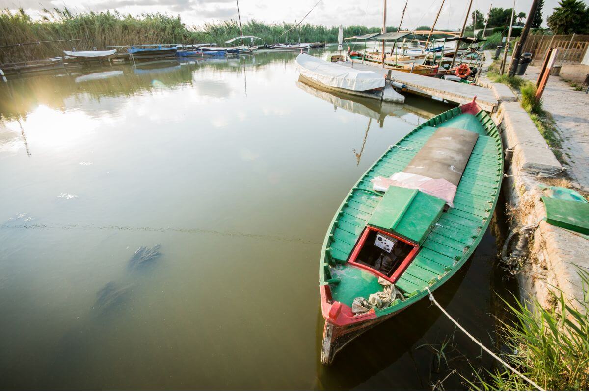
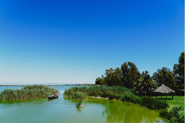
Immerse yourself in the serenity of the Albufera Natural Park as you cruise on its tranquil waters. Discover charming rural trails winding through the Valencian orchard, delighting in the view of ancient farmhouses and picturesque huts.
How about a unique experience in a traditional carriage to add an authentic touch to your adventure?

Here, we provide everything you need to plan your visit to this corner of Valencian nature. From transportation options to details about the finest gastronomic experiences, we’re here to make your getaway unforgettable.
Uncover the most original proposals to immerse yourself in Valencian tradition and live unforgettable moments surrounded by nature.
Don’t miss this unique opportunity to connect with the essence of Valencia!
Explore the natural beauty of Valencia with our guided tours to the Albufera!
What to do in the Albufera Natural Park of Valencia?
Discover a wide range of exciting activities awaiting you in the Albufera Natural Park of Valencia. From relaxing boat rides to fascinating excursions through lush vegetation, here you’ll find options to suit every taste and age.
Immerse yourself in the natural beauty of this unique enclave and let yourself be captivated by the experiences it offers.
Gola del Pujol Viewpoint
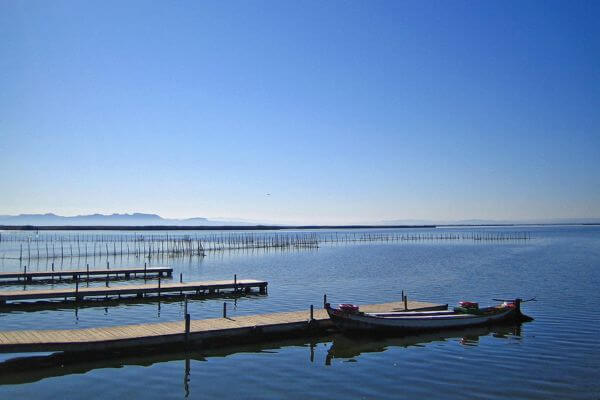
A renowned viewpoint celebrated for its stunning sunsets and boat rides.
Situated at the Gola del Pujol, one of the three channels directly connecting l’Albufera with the Mediterranean Sea.
It provides an excellent vantage point of the lagoon throughout the year, with ample opportunities for birdwatching, especially between October and March when the “redolins“, fixed fishing posts, attract a variety of avifauna.
Besides being the prime spot to witness one of the best sunsets in the natural park, there’s a permanent boat service available year-round (except on days of adverse weather) offering 40-minute rides around l’Albufera.
From this point, you can also access La Devesa area by foot.
La Devesa & Estany del Pujol
La Devesa, located within the municipality of Valencia, spans 10 km of the 30 km stretch that separates l’Albufera from the Mediterranean Sea.
This coastal strip, or “restinga”, which runs through the natural park from north to south, originates from the sands carried by the drift current that have reached the sea from the contributions of the Turia River.
La Devesa has an approximate width of 1 km and covers an area of about 850 ha. It is the only area of the restinga that currently maintains a well-preserved dune system and Mediterranean forest, as the rest is largely occupied by urban developments.
The highlight of La Devesa is the walking or cycling routes available. Information on the 6 marked hiking and/or cycling trails in this area can be found in informational brochures. Each route is identified by a color and focuses on a different theme.
The Estany del Pujol is a historical anomaly within the landscape of La Devesa. It was built in the early 1970s as part of an ambitious urban project that included a marina for boats to dock. After the project was abandoned and the area was restored through dune regeneration and vegetation work, there was consideration of filling in the lake, which reaches depths of up to 4 meters in some areas and is sustained by seawater contributions.
However, the idea was dismissed due to the high cost involved. Over the years, vegetation has surrounded the lake, making it an integral part of La Devesa’s routes and an added attraction to the natural park.
Today, it serves not only as a recreational area for visitors but also as an artificial lake with high ecological potential for a variety of water birds, providing refuge and food.
Among the diverse botanical species, the sea juniper stands out, being severely threatened.
Racó de L’Olla Interpretation Center
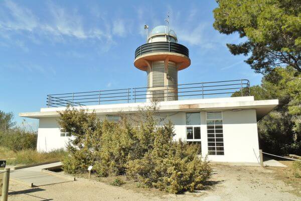
Racó de L’Olla is a geologically depressed area nestled in the heart of the Albufera Natural Park, between La Devesa and l’Albufera, serving as a transition zone between both environments. Located in this enclave is the Racó de L’Olla Nature Reserve, a place of high botanical and ornithological interest.
At the Interpretation Center, you can enjoy an incredible panoramic view from the Observation Tower. Explore the exhibition about the Racó de L’Olla Nature Reserve and the Albufera Natural Park.
Observe a wide variety of birds from the birdwatching observatories (bringing binoculars is recommended). Learn about plant species native to the fixed dunes of La Devesa through the interpretive trail.
El Palmar
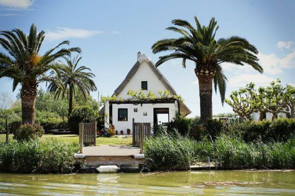
Another recommended starting point for exploring the park is El Palmar. It’s also the starting point for boat rides on l’Albufera throughout the year.
Today, this village is a suburb of the city of Valencia with a population of around 800 inhabitants, situated amidst rice fields.
Its economic activity is based on fishing, rice and vegetable agriculture, hospitality, and ecotourism. The earliest indications of El Palmar’s existence date back to the time of Muslim occupation in 711 AD. Some Arabic texts refer to the “alquería” of Alcudia, geographically located where El Palmar stands today.
It wasn’t until 1238 when King James I of Aragon conquered the Kingdom of Valencia and distributed it among Christian settlers, reserving l’Albufera and its “Devesa” for himself. In 1250, James I granted the right to fish in exchange for a tribute of 1/5 of the catches made.
By the mid-18th century, population settled in El Palmar, coming from neighboring towns like Catarroja, Silla, or Ruzafa, who had previously built the first “barracas” to store fishing tools in l’Albufera, shelter from storms, and flooding.
From the 18th century onwards, these “barracas” became the residence of fishermen and their families. However, in 1883, El Palmar suffered a major fire, leaving half of the village burnt. During the subsequent reconstruction, the traditional “barraca” began to be replaced by more contemporary buildings. Today, El Palmar still preserves some of the traditional “barracas”, along with other buildings related to rice culture, such as the Tocaio Threshing House.
Although rice cultivation was widespread around l’Albufera, it wasn’t until the late 19th century that fishermen from El Palmar began to cultivate it, as until then, fishing was more profitable. Between 1931 and 1933, three bridges were built over the irrigation channels surrounding El Palmar, connecting it to the Nazaret-Oliva road (CV-500).
The novels “La Barraca” (1892) and “Cañas y Barro” (1902) by Vicente Blasco Ibáñez are inspired by El Palmar, l’Albufera, and its people.
Its gastronomy is one of its highlights, with typical dishes to savor in its more than 30 restaurants throughout the year. Paella and All i Pebre are its most renowned dishes.
El Palmar is a recognized gastronomic destination that attracts thousands of visitors throughout the year.
Tancat de Mília & Portet de Sollana Viewpoint Tower
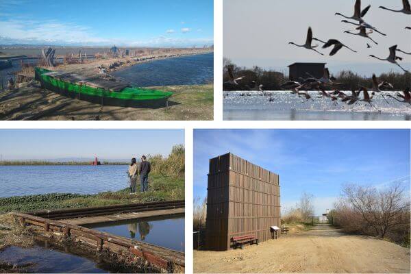
This observation tower is located on the shores of l’Albufera, offering unbeatable views. It is the first freely accessible tower in this natural space, providing a 360-degree panoramic view of the landscape and fauna of the Tancat de Milia artificial wetland, the rice fields, and l’Albufera.
Visiting the interior of the Tancat de Milia artificial wetland is exclusively by prior reservation.
The construction of the tower is an initiative of the Department of Environment, with the support of the Sollana City Council (València), Acuamed, and Pavagua-Ambiental. Recycled plastics and rice straw were used in its manufacture.
Access is by foot from the Portet de Sollana. Please do not drive past the existing chain, even if it is lowered.
The tower is located 400 meters from the Portet de Sollana, which is of great scenic beauty. A trail connects these two points.
The Portet de Sollana is one of the entry points by boat from l’Albufera in Sollana.
According to Juan Moleres, the official chronicler of Sollana in his book “History of Sollana“, records of this port date back to 1579, although it is believed to have existed before. Some early 20th-century maps show a canal called “El Portet de Sollana” and a “Redolí de la Pesquera” from El Palmar still referred to as “Redolí del Portet de Sollana“.
The small port invites us to stroll and enjoy the surroundings and its albufera boats, or to relax in the picnic area located there.
Muntanyeta dels Sants
The “Muntanyeta dels Sants“, located in the Malvinaret area (Sueca), is a privileged spot amidst the plain, offering the best perspective of the rice fields in their ever-changing physiognomy.
This limestone promontory, situated 27 meters above sea level, provides a glimpse of what l’Albufera was like in its primordial stage when it extended beyond the boundaries of the current 21,120-hectare natural park.
Crowning this relief is the hermitage of Saints Abdón and Senén “Els Benissants de la pedra“, built in 1613 on a previous Gothic structure. These saints are secondary patrons of the city of Sueca and protectors of the crop against hail, leading to the name change from “Tossal de Na Molins” to “Muntanyeta dels Sants“.
Of the primitive existing archipelago, only this “Muntanyeta” remains, marked by the boreholes once used for quarrying stone. The rest were completely razed for this purpose.
Standing out at its summit is the hermitage of Saints Abdón and Senén “Els Benissants de la pedra“.
From a landscape perspective, the changes in the rice field scenery are gradual and fascinating throughout the year.
The end of winter and the beginning of spring coincide with the driest stage of the wetland, all dry, brown, with tractors turning the earth, preparing the rice fields for planting in May with the new water inflow.
As spring progresses into summer, the rice grows, and as the grains begin to ripen, the green tones give way to yellows and ochres that blanket the marshland, signaling the end of summer and the beginning of autumn with the grain harvest. After this stage, the stubble is left in the fields, plowed under, or removed in some cases.
Subsequently, there is the second flooding of a portion of the rice fields known as “la perelloná”, resembling an older marsh, providing shelter for thousands of waterfowl migrating from colder regions to spend the winter in this wetland area.
In the “Cova del Drac” (Dragon’s Cave), stalactites and stalagmites can be seen. In this cave and in the “burro” cave, calcite is transparent or white and turns pink, golden, yellow, orange, peach, red when other compounds adhere to it during formation.
Although it may not seem so, many locals remember going inside and observing the galleries and flowing water.
A small school once existed in Muntanyeta, now transformed into public services.
The Ullal de Baldoví reserve
Ullals are springs or underground water sources, typically freshwater, that often form small lagoons. These enclaves host one of the priority habitats under European legislation: calcareous fens with Cladius mariscus (a type of sedge).
Priority habitats are natural habitats of significant interest for biodiversity conservation within the European Union territory.
Fens constitute characteristic environments of relatively undisturbed marshlands, harboring a high number of plants and animals, some of which are very rare or endangered.
In the Albufera Natural Park, close to 40 ullals have been inventoried, scattered throughout the rice fields or forming a rosary-like pattern along the park’s western perimeter.
Ullals are an integral part of the wetland’s hydrological system, representing surface outcrops of water, generally of excellent quality. They continue to play a crucial role as water supply areas free from pollutant load and as true genetic and biodiversity reserves.
Thanks to the excellent quality of their waters, ullals host endemic species exclusive to the Valencian territory or the Iberian Mediterranean.
The Ullal de Baldoví reserve is located near the Muntanyeta dels Sants. It is part of the Na Molins Ullals reserve area along with Ullal dels Sants, covering a total area of 5.6 hectares and featuring various natural environments (reed beds, bulrushes, and reed marshes) as well as numerous plant and animal species.
Before its restoration in 2006 (Life Ullals), the Ullal de Baldoví had a smaller surface area, with little typical vegetation growing along its shores.
This ullal is the largest spring in the natural park, with a lagoon area of 0.45 hectares, a depth of up to 3 meters, and a flow rate close to 250 liters per second.
The reserve is equipped with a wooden walkway, an observatory, and a viewpoint to observe the most representative fauna and flora species and enjoy the surrounding landscape.
Port of Catarroja
The Port of Catarroja is a must-visit destination in the Albufera Natural Park.
Located east of the town of Catarroja, starting from its industrial estate, we find its port, one of the entry points to l’Albufera. Through a channel that runs almost parallel to the Chiva ravine, we can navigate to the lagoon.
The original port, of Roman origin, began at the end of the Rambleta area but disappeared in the 16th century when the reforms that can be seen today in the current port were made. The needs of the local population made the original port too small.
At the entrance of the port, there is a shipwright workshop, where even today, boats used in the area are constructed and repaired.
In addition to its scenic charm, you can taste the traditional cuisine of the area, such as its famous “allipebre” eel stew.
When is it best to visit the Albufera of Valencia?
The best time to visit the Albufera de Valencia is from November to January. During this period, you can enjoy a unique natural spectacle that makes this lake the largest in Spain.
During “La Perellonà”, as this phenomenon is known, the Albufera reaches its maximum splendor. Farmers close the floodgates on El Perelló beach to flood the rice fields for more than 2 months. This process completely transforms the landscape, flooding roads, banks and ditches.
With an area that can be around 17,500 hectares, the Albufera acquires an impressive magnitude during the winter, recovering its original extension from the end of the 18th century.
This phenomenon marks the beginning of the rice cycle, the most important agricultural crop in the region. The process culminates with the harvesting of the grain in May and the burning of the stubble in September and October.
La Albufera in this period offers a unique landscape, full of natural beauty and an incomparable opportunity to experience the essence of this region.
Let Me Assist You in Your Visit to Albufera
At MPC Travel Spain, we are dedicated to providing you with an unforgettable experience during your visit to the Albufera of Valencia. With our guided tour, we assure you:
- Expert knowledge: Our guides are highly trained and possess deep insight into the ecosystem and history of the Albufera. They offer you a more comprehensive and enriching understanding of this fascinating natural environment.
- Enriching experience: With the assistance of our guides, you will uncover the best-kept secrets of the Albufera and appreciate its beauty in an entirely new way. You will learn about the local flora and fauna, as well as the cultural and environmental significance of this protected area.
- Comfort and safety: Our guided tours provide maximum comfort and safety, especially for those unfamiliar with the area. We ensure a seamless journey, allowing you to fully enjoy every moment without worry.
Discover the Albufera of Valencia with us and embark on a unique and memorable experience. Book now and let us guide you through this exciting adventure!
You might also be interested...
Ready to embark on your dream vacation? Contact us today to start planning your unforgettable journey through the beautiful regions of Andalusia and the Valencian Community!
